
Taree topographic map
Interactive map
Click on the map to display elevation.
About this map
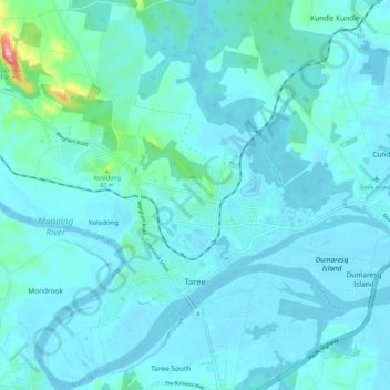
Name: Taree topographic map, elevation, terrain.
Location: Taree, Mid-Coast Council, New South Wales, 2430, Australia (-31.93833 152.39938 -31.84501 152.51154)
Average elevation: 17 m
Minimum elevation: -4 m
Maximum elevation: 185 m