
Sauda topographic map
Interactive map
Click on the map to display elevation.
About this map
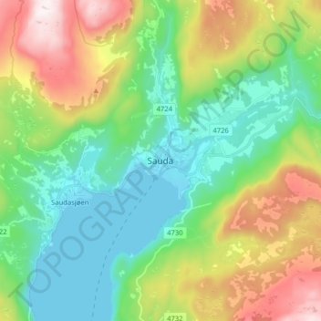
Name: Sauda topographic map, elevation, terrain.
Location: Sauda, Rogaland, 4200, Norvège (59.61057 6.31375 59.69057 6.39375)
Average elevation: 341 m
Minimum elevation: 0 m
Maximum elevation: 1,056 m
Other topographic maps
Click on a map to view its topography, its elevation and its terrain.