
Shiner topographic map
Interactive map
Click on the map to display elevation.
About this map
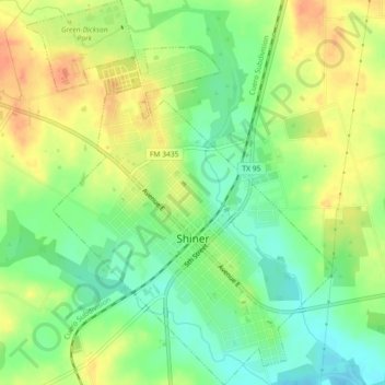
Name: Shiner topographic map, elevation, terrain.
Location: Shiner, Lavaca County, Texas, 77984, United States (29.41493 -97.19167 29.45435 -97.15491)
Average elevation: 113 m
Minimum elevation: 92 m
Maximum elevation: 134 m
Other topographic maps
Click on a map to view its topography, its elevation and its terrain.
Good Hope
United States > Texas > Lavaca County
Good Hope, Lavaca County, Texas, 77964, United States
Average elevation: 83 m
Hallettsville
United States > Texas > Lavaca County > Hallettsville
Hallettsville, Lavaca County, Texas, United States
Average elevation: 77 m