
La Barrière topographic map
Interactive map
Click on the map to display elevation.
About this map
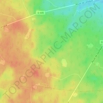
Name: La Barrière topographic map, elevation, terrain.
Average elevation: 128 m
Minimum elevation: 100 m
Maximum elevation: 146 m
Other topographic maps
Click on a map to view its topography, its elevation and its terrain.
La Fontan
France > Nouvelle-Aquitaine > Lot-et-Garonne > Pindères
La Fontan, Pindères, Nérac, Lot-et-Garonne, Nouvelle-Aquitaine, France métropolitaine, 47700, France
Average elevation: 101 m