
Thank you for supporting this site ❤️
Make a donation
Make a donation
Big Fork topographic map
Click on the map to display elevation.
Thank you for supporting this site ❤️
Make a donation
Make a donation
About this map
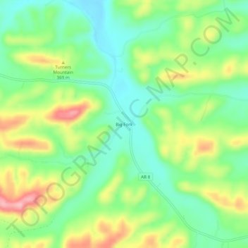
Name: Big Fork topographic map, elevation, terrain.
Location: Big Fork, Polk County, Arkansas, United States (34.46650 -93.98992 34.50650 -93.94992)
Average elevation: 353 m
Minimum elevation: 295 m
Maximum elevation: 446 m
Thank you for supporting this site ❤️
Make a donation
Make a donation
Other topographic maps
Click on a map to view its topography, its elevation and its terrain.