
猫鼻梁 topographic map
Interactive map
Click on the map to display elevation.
About this map
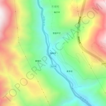
Name: 猫鼻梁 topographic map, elevation, terrain.
Location: 猫鼻梁, 虎跳峡镇, 香格里拉市, 迪庆藏族自治州, 云南省, 中国 (27.20683 100.00625 27.24683 100.04625)
Average elevation: 2,408 m
Minimum elevation: 1,901 m
Maximum elevation: 3,107 m
Other topographic maps
Click on a map to view its topography, its elevation and its terrain.