
Thank you for supporting this site ❤️
Make a donation
Make a donation
Marysville topographic map
Click on the map to display elevation.
Thank you for supporting this site ❤️
Make a donation
Make a donation
About this map
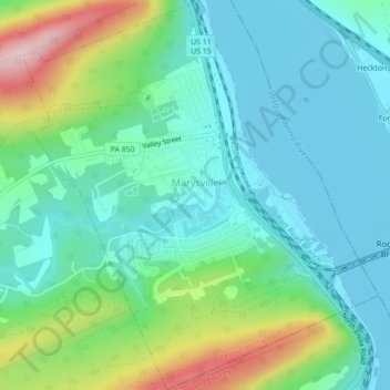
Name: Marysville topographic map, elevation, terrain.
Location: Marysville, Perry County, Pennsylvania, United States (40.32016 -76.94788 40.35608 -76.91497)
Average elevation: 168 m
Minimum elevation: 92 m
Maximum elevation: 379 m
Thank you for supporting this site ❤️
Make a donation
Make a donation
Other topographic maps
Click on a map to view its topography, its elevation and its terrain.