

Make a donation
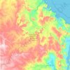
Mount Barker topographic map
Click on the map to display elevation.
Make a donation
Mount Barker
The peak of Mount Barker lies 3.5 kilometres (2.2 mi) southwest of the town centre, and reaches an elevation of 404 metres (1,325 ft) above sea level. A sealed road leads to the base of a radio and television tower on the summit of the hill. The tower was constructed to a height of 168 metres (551 ft) in 1966, and extended to 193 metres (633 ft) in 2001. Views extend north to the Stirling Range and east to the Porongurup Range. An elevated concrete lookout provides views south to Albany and southwest toward Denmark. On clear days the Albany Wind Farm is visible 45 kilometres (28 mi) away to the south. In summer months the hill lookout is used to monitor risk posed by any nearby bushfires.
Make a donation
About this map

Name: Mount Barker topographic map, elevation, terrain.
Location: Mount Barker, Western Australia, 6324, Australia (-34.72472 117.46680 -34.52153 117.80881)
Average elevation: 211 m
Minimum elevation: 58 m
Maximum elevation: 475 m
Make a donation
Other topographic maps
Click on a map to view its topography, its elevation and its terrain.
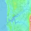
Perth
Perth, the capital of Western Australia, is situated on the Swan Coastal Plain, a flat expanse of sandy soil nestled between the Indian Ocean to the west and the Darling Scarp to the east. The Darling Scarp, also known as the Darling Range, is a low escarpment that extends north–south, marking a distinct…
Average elevation: 26 m
Make a donation
Rockingham
Australia > Western Australia > Rockingham
Rockingham is topographically flat, has sandy soils and coastal vegetation. It has a northern aspect to Cockburn Sound, from Rockingham Beach and Palm Beach.
Average elevation: 4 m
Perth
Perth, the capital of Western Australia, is situated on the Swan Coastal Plain, a flat expanse of sandy soil nestled between the Indian Ocean to the west and the Darling Scarp to the east. The Darling Scarp, also known as the Darling Range, is a low escarpment that extends north–south, marking a distinct…
Average elevation: 26 m
Make a donation
Make a donation


Make a donation


Make a donation

Make a donation

Make a donation

Mount Meharry
The summit of Mount Meharry can be reached from the Great Northern Highway via an unsealed road 16 kilometres (9.9 mi) in length and a vehicular track 21 kilometres (13 mi) in length. Permission should be sought from the managers of the land over which the road and track pass. These are Juna Downs Station and…
Average elevation: 1,030 m

Make a donation

Make a donation
Make a donation


Make a donation

Make a donation


Make a donation




Make a donation


Make a donation


Make a donation



Make a donation


Make a donation


Make a donation



Make a donation


Make a donation




Make a donation


Make a donation


Make a donation



Make a donation