
Thank you for supporting this site ❤️
Make a donation
Make a donation
Pilot Rock topographic map
Click on the map to display elevation.
Thank you for supporting this site ❤️
Make a donation
Make a donation
About this map
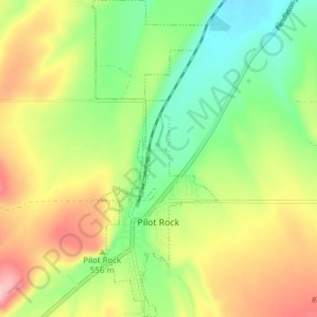
Name: Pilot Rock topographic map, elevation, terrain.
Location: Pilot Rock, Umatilla County, Oregon, 97868, United States (45.46959 -118.84332 45.51535 -118.81762)
Average elevation: 527 m
Minimum elevation: 453 m
Maximum elevation: 625 m
Thank you for supporting this site ❤️
Make a donation
Make a donation
Other topographic maps
Click on a map to view its topography, its elevation and its terrain.