
Brown County topographic map
Interactive map
Click on the map to display elevation.
About this map
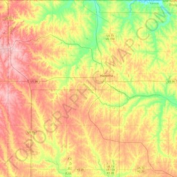
Name: Brown County topographic map, elevation, terrain.
Location: Brown County, Kansas, United States (39.65261 -95.78897 40.00046 -95.33972)
Average elevation: 335 m
Minimum elevation: 261 m
Maximum elevation: 407 m
Other topographic maps
Click on a map to view its topography, its elevation and its terrain.
Everest
United States > Kansas > Brown County
Everest, Brown County, Kansas, United States
Average elevation: 346 m
Horton
United States > Kansas > Brown County
Horton, Brown County, Kansas, United States
Average elevation: 327 m