
Thank you for supporting this site ❤️
Make a donation
Make a donation
Galoya topographic map
Click on the map to display elevation.
Thank you for supporting this site ❤️
Make a donation
Make a donation
About this map
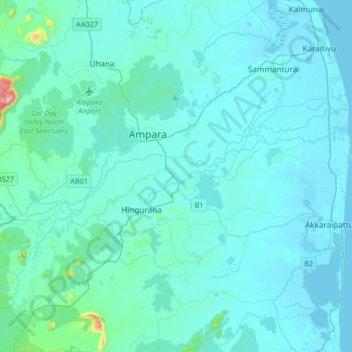
Name: Galoya topographic map, elevation, terrain.
Location: Galoya, Ampara District, Eastern Province, Sri Lanka (7.21218 81.53857 7.30495 81.86627)
Average elevation: 37 m
Minimum elevation: -2 m
Maximum elevation: 582 m
Thank you for supporting this site ❤️
Make a donation
Make a donation
Other topographic maps
Click on a map to view its topography, its elevation and its terrain.
Thank you for supporting this site ❤️
Make a donation
Make a donation
Thank you for supporting this site ❤️
Make a donation
Make a donation
Thank you for supporting this site ❤️
Make a donation
Make a donation
Thank you for supporting this site ❤️
Make a donation
Make a donation
Thank you for supporting this site ❤️
Make a donation
Make a donation