
Thank you for supporting this site ❤️
Make a donation
Make a donation
Arlington topographic map
Click on the map to display elevation.
Thank you for supporting this site ❤️
Make a donation
Make a donation
About this map
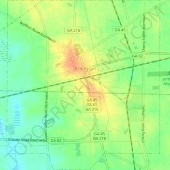
Name: Arlington topographic map, elevation, terrain.
Location: Arlington, Calhoun County, Georgia, United States (31.42070 -84.74233 31.45281 -84.70838)
Average elevation: 77 m
Minimum elevation: 58 m
Maximum elevation: 98 m
Thank you for supporting this site ❤️
Make a donation
Make a donation