
Thank you for supporting this site ❤️
Make a donation
Make a donation
Grünenberg topographic map
Click on the map to display elevation.
Thank you for supporting this site ❤️
Make a donation
Make a donation
Grünenberg
In der Preußischen Uraufnahme von 1840 wird Grünenberg erstmals mit umgrenztem Hofraum in den topografischen Karten verzeichnet.
Thank you for supporting this site ❤️
Make a donation
Make a donation
About this map
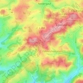
Name: Grünenberg topographic map, elevation, terrain.
Average elevation: 311 m
Minimum elevation: 239 m
Maximum elevation: 381 m
Thank you for supporting this site ❤️
Make a donation
Make a donation