
Логоза topographic map
Interactive map
Click on the map to display elevation.
About this map
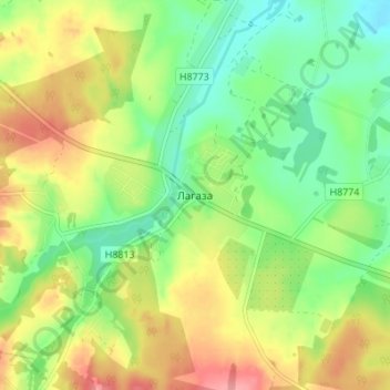
Name: Логоза topographic map, elevation, terrain.
Average elevation: 233 m
Minimum elevation: 194 m
Maximum elevation: 284 m
Other topographic maps
Click on a map to view its topography, its elevation and its terrain.
Корень
Беларусь > Минская область > Логойский район > Гайненский сельский Совет > Корень
Корень, Гайненский сельский Совет, Логойский район, Минская область, 223123, Беларусь
Average elevation: 241 m