
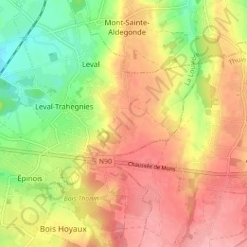
Bois d'Hamal topographic map
Interactive map
Click on the map to display elevation.
About this map
Name: Bois d'Hamal topographic map, elevation, terrain.
Average elevation: 155 m
Minimum elevation: 95 m
Maximum elevation: 202 m
Other topographic maps
Click on a map to view its topography, its elevation and its terrain.
Trieux de Leval
Belgique > Hainaut > La Louvière > Binche > Leval-Trahegnies
Trieux de Leval, Leval-Trahegnies, Binche, La Louvière, Hainaut, Wallonie, 7141, Belgique
Average elevation: 150 m
Leval-Trahegnies
Belgique > Hainaut > La Louvière > Binche > Leval-Trahegnies
Leval-Trahegnies, Binche, La Louvière, Hainaut, Wallonie, 7134, Belgique
Average elevation: 140 m