
Plage du Parc topographic map
Interactive map
Click on the map to display elevation.
About this map
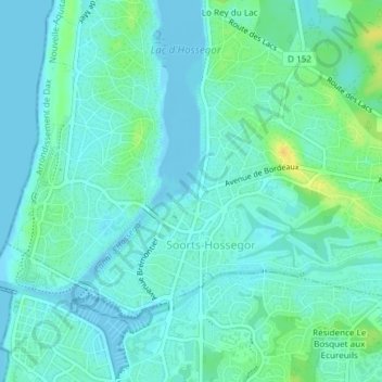
Name: Plage du Parc topographic map, elevation, terrain.
Average elevation: 6 m
Minimum elevation: -3 m
Maximum elevation: 25 m
Other topographic maps
Click on a map to view its topography, its elevation and its terrain.
Lac d'Hossegor
France > Nouvelle-Aquitaine > Soorts-Hossegor
Lac d'Hossegor, Avenue du Touring Club de France, Soorts, Soorts-Hossegor, Dax, Landes, Nouvelle-Aquitaine, France métropolitaine, 40150, France
Average elevation: 7 m