
Santo Stefano d'Aveto topographic map
Interactive map
Click on the map to display elevation.
About this map
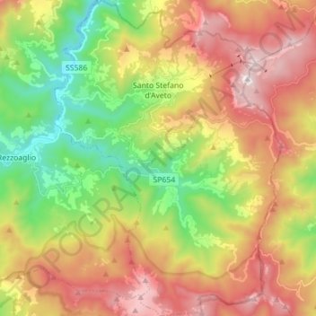
Name: Santo Stefano d'Aveto topographic map, elevation, terrain.
Location: Santo Stefano d'Aveto, Gênes, Ligurie, Italie (44.47570 9.40413 44.57564 9.50461)
Average elevation: 1,166 m
Minimum elevation: 626 m
Maximum elevation: 1,792 m