
Thank you for supporting this site ❤️
Make a donation
Make a donation
Quinchicoto topographic map
Click on the map to display elevation.
Thank you for supporting this site ❤️
Make a donation
Make a donation
About this map
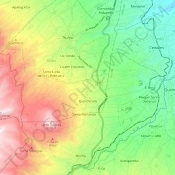
Name: Quinchicoto topographic map, elevation, terrain.
Location: Quinchicoto, Tisaleo, Tungurahua, Ecuador (-1.40141 -78.74863 -1.35574 -78.64478)
Average elevation: 3,277 m
Minimum elevation: 2,728 m
Maximum elevation: 4,054 m
Thank you for supporting this site ❤️
Make a donation
Make a donation
Other topographic maps
Click on a map to view its topography, its elevation and its terrain.