
Theydon Bois topographic map
Interactive map
Click on the map to display elevation.
About this map
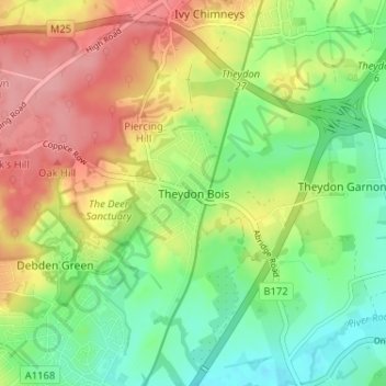
Name: Theydon Bois topographic map, elevation, terrain.
Location: Theydon Bois, Essex, East of England, Engeland, CM16 7EF, VK (51.65153 0.08074 51.69153 0.12074)
Average elevation: 64 m
Minimum elevation: 18 m
Maximum elevation: 121 m