
Thank you for supporting this site ❤️
Make a donation
Make a donation
Landkreis Ahrweiler topographic map
Click on the map to display elevation.
Thank you for supporting this site ❤️
Make a donation
Make a donation
About this map
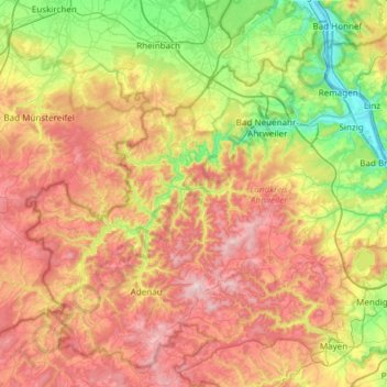
Name: Landkreis Ahrweiler topographic map, elevation, terrain.
Location: Landkreis Ahrweiler, Rhineland-Palatinate, Germany (50.30660 6.74323 50.64989 7.34454)
Average elevation: 341 m
Minimum elevation: 52 m
Maximum elevation: 715 m
Thank you for supporting this site ❤️
Make a donation
Make a donation
Other topographic maps
Click on a map to view its topography, its elevation and its terrain.
Pellenberg
Germany > Rhineland-Palatinate > Landkreis Trier-Saarburg > Merzkirchen
Average elevation: 347 m