
Custinne topographic map
Interactive map
Click on the map to display elevation.
About this map
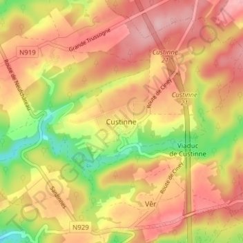
Name: Custinne topographic map, elevation, terrain.
Location: Custinne, Houyet, Dinant, Namur, Wallonie, 5562, Belgique (50.19177 5.02842 50.23177 5.06842)
Average elevation: 250 m
Minimum elevation: 159 m
Maximum elevation: 311 m
Other topographic maps
Click on a map to view its topography, its elevation and its terrain.
Grande Trussogne
Belgique > Namur > Dinant > Custinne > Grande Trussogne
Grande Trussogne, Custinne, Houyet, Dinant, Namur, Wallonie, 5562, Belgique
Average elevation: 242 m