
Thank you for supporting this site ❤️
Make a donation
Make a donation
Arrochela topographic map
Click on the map to display elevation.
Thank you for supporting this site ❤️
Make a donation
Make a donation
About this map
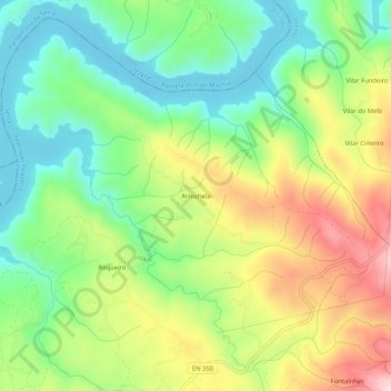
Name: Arrochela topographic map, elevation, terrain.
Location: Arrochela, Pedrógão Pequeno, Sertã, Castelo Branco, Portugal (39.91049 -8.11482 39.95049 -8.07482)
Average elevation: 406 m
Minimum elevation: 262 m
Maximum elevation: 628 m
Thank you for supporting this site ❤️
Make a donation
Make a donation