
Thank you for supporting this site ❤️
Make a donation
Make a donation
Glindenberg topographic map
Click on the map to display elevation.
Thank you for supporting this site ❤️
Make a donation
Make a donation
About this map
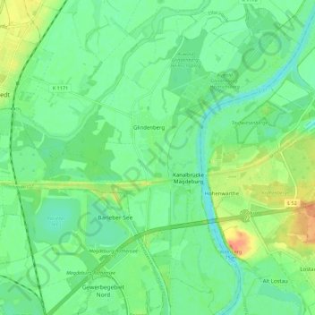
Name: Glindenberg topographic map, elevation, terrain.
Location: Glindenberg, Wolmirstedt, Börde, Sachsen-Anhalt, Deutschland (52.20078 11.66276 52.26880 11.73579)
Average elevation: 45 m
Minimum elevation: 30 m
Maximum elevation: 74 m
Thank you for supporting this site ❤️
Make a donation
Make a donation
Other topographic maps
Click on a map to view its topography, its elevation and its terrain.