
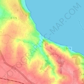
Moulin de Kerrot topographic map
Interactive map
Click on the map to display elevation.
About this map
Name: Moulin de Kerrot topographic map, elevation, terrain.
Average elevation: 38 m
Minimum elevation: 0 m
Maximum elevation: 84 m
Other topographic maps
Click on a map to view its topography, its elevation and its terrain.
Île Callot
France > Bretagne > Finistère > Carantec
Île Callot, Poul Morvan Bras, Carantec, Morlaix, Finistère, Bretagne, France métropolitaine, 29660, France
Average elevation: 0 m
Espace du Kelenn
France > Bretagne > Finistère > Carantec
Espace du Kelenn, Carantec, Morlaix, Finistère, Bretagne, France métropolitaine, 29660, France
Average elevation: 9 m
La Grande Grève
France > Bretagne > Finistère > Carantec
La Grande Grève, Carantec, Morlaix, Finistère, Bretagne, France métropolitaine, 29660, France
Average elevation: 22 m