
Penn ar Menez topographic map
Interactive map
Click on the map to display elevation.
About this map
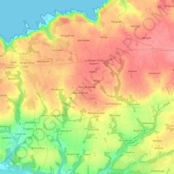
Name: Penn ar Menez topographic map, elevation, terrain.
Average elevation: 54 m
Minimum elevation: 0 m
Maximum elevation: 92 m
Other topographic maps
Click on a map to view its topography, its elevation and its terrain.
Kervalguen
France > Bretagne > Finistère > Goulien
Kervalguen, Goulien, Quimper, Finistère, Bretagne, France métropolitaine, 29770, France
Average elevation: 44 m
Deux stèles protohistoriques
France > Bretagne > Finistère > Goulien > Penn ar Menez
Deux stèles protohistoriques, Place de l'Église, Penn ar Menez, Goulien, Quimper, Finistère, Bretagne, France métropolitaine, 29770, France
Average elevation: 62 m