
Thank you for supporting this site ❤️
Make a donation
Make a donation
Chã topographic map
Click on the map to display elevation.
Thank you for supporting this site ❤️
Make a donation
Make a donation
About this map
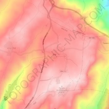
Name: Chã topographic map, elevation, terrain.
Location: Chã, Vila Chã, Alijó, Vila Real, 5070-302, Portugal (41.30434 -7.48755 41.34434 -7.44755)
Average elevation: 742 m
Minimum elevation: 489 m
Maximum elevation: 825 m
Thank you for supporting this site ❤️
Make a donation
Make a donation