
Taubendorf topographic map
Interactive map
Click on the map to display elevation.
About this map
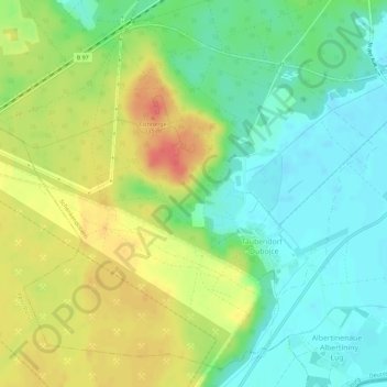
Name: Taubendorf topographic map, elevation, terrain.
Average elevation: 77 m
Minimum elevation: 52 m
Maximum elevation: 113 m
Other topographic maps
Click on a map to view its topography, its elevation and its terrain.
Groß Gastrose
Deutschland > Brandenburg > Spree-Neiße > Schenkendöbern
Groß Gastrose, Schenkendöbern, Spree-Neiße, Brandenburg, Deutschland
Average elevation: 63 m