
Thank you for supporting this site ❤️
Make a donation
Make a donation
Sameiro topographic map
Click on the map to display elevation.
Thank you for supporting this site ❤️
Make a donation
Make a donation
About this map
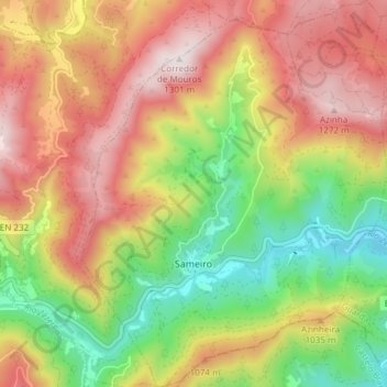
Name: Sameiro topographic map, elevation, terrain.
Location: Sameiro, Manteigas, Guarda, Portugal (40.39063 -7.51122 40.44782 -7.45160)
Average elevation: 924 m
Minimum elevation: 553 m
Maximum elevation: 1,297 m
Thank you for supporting this site ❤️
Make a donation
Make a donation
Other topographic maps
Click on a map to view its topography, its elevation and its terrain.