
Osterende topographic map
Interactive map
Click on the map to display elevation.
About this map
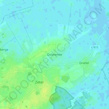
Name: Osterende topographic map, elevation, terrain.
Average elevation: 4 m
Minimum elevation: -2 m
Maximum elevation: 13 m
Other topographic maps
Click on a map to view its topography, its elevation and its terrain.
Bohlenberge
Deutschland > Niedersachsen > Landkreis Friesland > Zetel
Bohlenberge, Zetel, Landkreis Friesland, Niedersachsen, 26340, Deutschland
Average elevation: 5 m
Neuenburg
Deutschland > Niedersachsen > Landkreis Friesland > Zetel
Neuenburg, Zetel, Landkreis Friesland, Niedersachsen, 26340, Deutschland
Average elevation: 10 m