
Thank you for supporting this site ❤️
Make a donation
Make a donation
Topdalsfjorden topographic map
Click on the map to display elevation.
Thank you for supporting this site ❤️
Make a donation
Make a donation
About this map
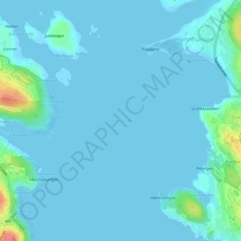
Name: Topdalsfjorden topographic map, elevation, terrain.
Location: Topdalsfjorden, Hamresanden, Kristiansand, Agder, 4651, Norge (58.18318 8.06417 58.18328 8.06427)
Average elevation: 7 m
Minimum elevation: -1 m
Maximum elevation: 83 m
Thank you for supporting this site ❤️
Make a donation
Make a donation
Other topographic maps
Click on a map to view its topography, its elevation and its terrain.