
Thank you for supporting this site ❤️
Make a donation
Make a donation
La Estación topographic map
Click on the map to display elevation.
Thank you for supporting this site ❤️
Make a donation
Make a donation
About this map
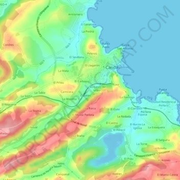
Name: La Estación topographic map, elevation, terrain.
Location: La Estación, Candás, Carreño, Asturias, 33430, España (43.56500 -5.79117 43.60500 -5.75117)
Average elevation: 44 m
Minimum elevation: -13 m
Maximum elevation: 123 m
Thank you for supporting this site ❤️
Make a donation
Make a donation