
Thank you for supporting this site ❤️
Make a donation
Make a donation
La Junta topographic map
Click on the map to display elevation.
Thank you for supporting this site ❤️
Make a donation
Make a donation
About this map
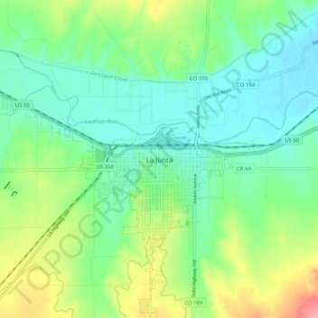
Name: La Junta topographic map, elevation, terrain.
Location: La Junta, Otero County, Colorado, 81050, United States (37.94501 -103.58383 38.02501 -103.50383)
Average elevation: 1,261 m
Minimum elevation: 1,229 m
Maximum elevation: 1,332 m
Thank you for supporting this site ❤️
Make a donation
Make a donation