
Thank you for supporting this site ❤️
Make a donation
Make a donation
Zwevezele topographic map
Click on the map to display elevation.
Thank you for supporting this site ❤️
Make a donation
Make a donation
Zwevezele
Zwevezele ligt op de overgang van Zandig Vlaanderen (in het noorden) naar Zandlemig Vlaanderen (in het zuiden). De hoogte bedraagt 18-44 meter en het landschap is licht heuvelig. Een waterloop is de Jobeek welke in noordelijke richting stroomt. In het noorden vindt men de Munkebossen.
Thank you for supporting this site ❤️
Make a donation
Make a donation
About this map
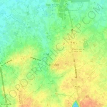
Name: Zwevezele topographic map, elevation, terrain.
Average elevation: 30 m
Minimum elevation: 12 m
Maximum elevation: 50 m
Thank you for supporting this site ❤️
Make a donation
Make a donation
Other topographic maps
Click on a map to view its topography, its elevation and its terrain.