
Ditchling Beacon topographic map
Interactive map
Click on the map to display elevation.
About this map
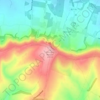
Name: Ditchling Beacon topographic map, elevation, terrain.
Average elevation: 144 m
Minimum elevation: 65 m
Maximum elevation: 252 m
Other topographic maps
Click on a map to view its topography, its elevation and its terrain.
Glynde
Vereinigtes Königreich > England > East Sussex > Lewes > Glynde
Glynde, Lewes, East Sussex, England, Vereinigtes Königreich
Average elevation: 31 m
Lewes
Vereinigtes Königreich > England > East Sussex > Lewes
Lewes, East Sussex, Südostengland, England, Vereinigtes Königreich
Average elevation: 40 m