
Gunung Penanjakan topographic map
Interactive map
Click on the map to display elevation.
About this map
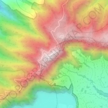
Name: Gunung Penanjakan topographic map, elevation, terrain.
Location: Gunung Penanjakan, Pasuruan, Ost-Java, Indonesien (-7.90378 112.95209 -7.90368 112.95219)
Average elevation: 2,427 m
Minimum elevation: 2,041 m
Maximum elevation: 2,749 m