
Tinajo topographic map
Interactive map
Click on the map to display elevation.
About this map
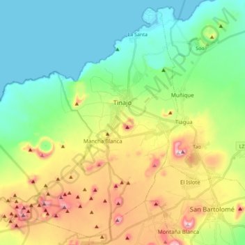
Name: Tinajo topographic map, elevation, terrain.
Location: Tinajo, Las Palmas, Canarias, 35560, España (28.98450 -13.80730 29.12380 -13.63768)
Average elevation: 181 m
Minimum elevation: 0 m
Maximum elevation: 546 m
Other topographic maps
Click on a map to view its topography, its elevation and its terrain.