
Comatrana topographic map
Interactive map
Click on the map to display elevation.
About this map
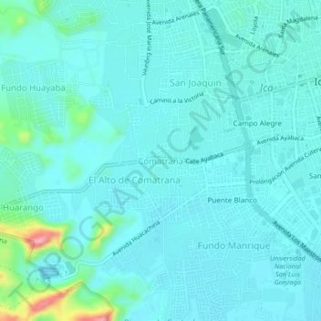
Name: Comatrana topographic map, elevation, terrain.
Location: Comatrana, Ica, 11004, Perú (-14.09397 -75.76974 -14.05397 -75.72974)
Average elevation: 412 m
Minimum elevation: 394 m
Maximum elevation: 524 m
Other topographic maps
Click on a map to view its topography, its elevation and its terrain.
Virgen Asunta
Perú > Ica > Ica > Carlos Ramos Loyza
Virgen Asunta, Señor de Luren, Parque Industrial, Carlos Ramos Loyza, Ica, Perú
Average elevation: 420 m
Upis El Huarango
Perú > Ica > Ica > Upis El Huarango
Upis El Huarango, Ica, Provincia de Ica, Ica, +56, Perú
Average elevation: 447 m