
Thank you for supporting this site ❤️
Make a donation
Make a donation
Crosskirk topographic map
Click on the map to display elevation.
Thank you for supporting this site ❤️
Make a donation
Make a donation
About this map
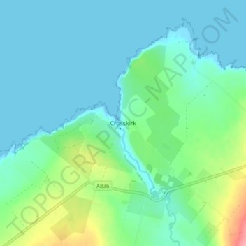
Name: Crosskirk topographic map, elevation, terrain.
Location: Crosskirk, Caithness, Scotland, KW14 7UZ, United Kingdom (58.58663 -3.69147 58.62663 -3.65147)
Average elevation: 20 m
Minimum elevation: -1 m
Maximum elevation: 96 m
Thank you for supporting this site ❤️
Make a donation
Make a donation
Other topographic maps
Click on a map to view its topography, its elevation and its terrain.