
Frabosa Sottana topographic map
Interactive map
Click on the map to display elevation.
About this map
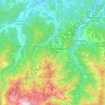
Name: Frabosa Sottana topographic map, elevation, terrain.
Location: Frabosa Sottana, Cuneo, Piemonte, Italia (44.22378 7.73829 44.34449 7.80968)
Average elevation: 1,009 m
Minimum elevation: 480 m
Maximum elevation: 2,303 m