
Saint-Véran topographic map
Interactive map
Click on the map to display elevation.
About this map
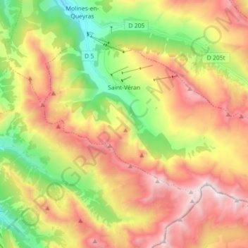
Name: Saint-Véran topographic map, elevation, terrain.
Average elevation: 2,381 m
Minimum elevation: 1,689 m
Maximum elevation: 3,135 m
Saint-Véran is de op twee na hoogste gemeente van Europa, na Trepalle in Italië en Juf in Zwitserland; het centrum ligt op 2042 m hoogte. De naam van de gemeente verwijst naar bisschop Veranus van Cavaillon.