
Martigny topographic map
Interactive map
Click on the map to display elevation.
About this map
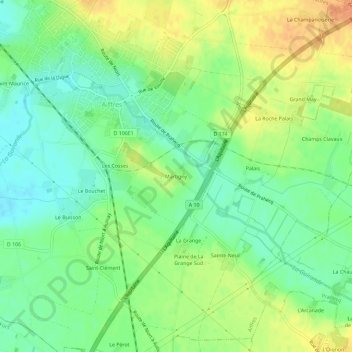
Name: Martigny topographic map, elevation, terrain.
Average elevation: 34 m
Minimum elevation: 17 m
Maximum elevation: 53 m
Other topographic maps
Click on a map to view its topography, its elevation and its terrain.
Les Cosses
France > Nouvelle-Aquitaine > Deux-Sèvres > Aiffres > Les Cosses
Les Cosses, Aiffres, Niort, Deux-Sèvres, Nouvelle-Aquitaine, France métropolitaine, 79230, France
Average elevation: 32 m
La Moie
France > Nouvelle-Aquitaine > Deux-Sèvres > Aiffres > La Moie
La Moie, Aiffres, Niort, Deux-Sèvres, Nouvelle-Aquitaine, France métropolitaine, 79230, France
Average elevation: 43 m