
Tothammer topographic map
Interactive map
Click on the map to display elevation.
About this map
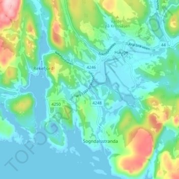
Name: Tothammer topographic map, elevation, terrain.
Location: Tothammer, Sogndalstrand, Sokndal, Rogaland, 4380, Norvège (58.31453 6.26012 58.35453 6.30012)
Average elevation: 51 m
Minimum elevation: -8 m
Maximum elevation: 225 m