
Eau Claire topographic map
Interactive map
Click on the map to display elevation.
About this map
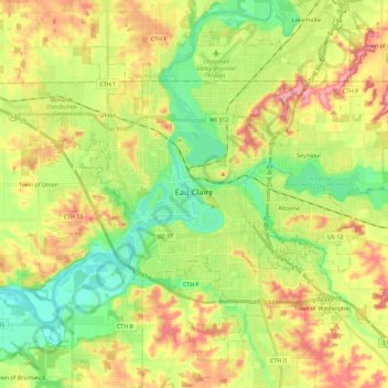
Name: Eau Claire topographic map, elevation, terrain.
Average elevation: 275 m
Minimum elevation: 223 m
Maximum elevation: 341 m
Other topographic maps
Click on a map to view its topography, its elevation and its terrain.
Fall Creek
États-Unis d'Amérique > Wisconsin > Eau Claire County
Fall Creek, Eau Claire County, Wisconsin, 54742, États-Unis d'Amérique
Average elevation: 290 m