
法库县 topographic map
Interactive map
Click on the map to display elevation.
About this map
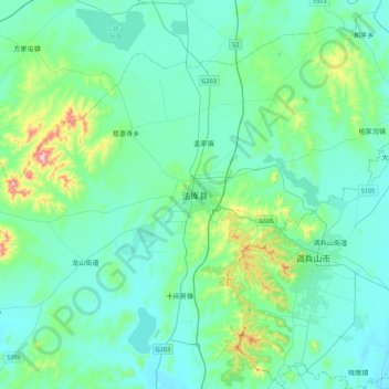
Name: 法库县 topographic map, elevation, terrain.
Location: 法库县, 沈阳市, 辽宁省, 中国 (42.34469 123.25234 42.66469 123.57234)
Average elevation: 115 m
Minimum elevation: 60 m
Maximum elevation: 428 m
Other topographic maps
Click on a map to view its topography, its elevation and its terrain.