
Bayehon topographic map
Interactive map
Click on the map to display elevation.
About this map
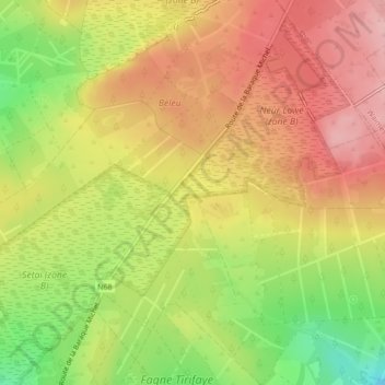
Name: Bayehon topographic map, elevation, terrain.
Location: Bayehon, Malmedy, Verviers, Luik, Wallonië, 4960, België (50.49158 6.06667 50.49164 6.06677)
Average elevation: 630 m
Minimum elevation: 541 m
Maximum elevation: 696 m
Other topographic maps
Click on a map to view its topography, its elevation and its terrain.
Reculémont
België > Luik > Malmedy > Bellevaux > Reculémont
Reculémont, Bellevaux, Malmedy, Verviers, Luik, Wallonië, 4960, België
Average elevation: 412 m
Trôs-Marèts
België > Luik > Malmedy > Bévercé
Trôs-Marèts, Bévercé, Malmedy, Verviers, Luik, Wallonië, 4960, België
Average elevation: 453 m