
Mallentin topographic map
Interactive map
Click on the map to display elevation.
About this map
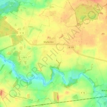
Name: Mallentin topographic map, elevation, terrain.
Average elevation: 26 m
Minimum elevation: 1 m
Maximum elevation: 46 m
Mallentin liegt zwischen Grevesmühlen und Dassow und ist etwa 22 km von Lübeck entfernt. Das Dorfgebiet am Unterlauf des Flusses Stepenitz ist leicht hügelig, mit 41 m über dem Meer wird bei Roxin die größte Höhe erreicht.