
Thank you for supporting this site ❤️
Make a donation
Make a donation
Denniston topographic map
Click on the map to display elevation.
Thank you for supporting this site ❤️
Make a donation
Make a donation
About this map
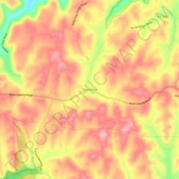
Name: Denniston topographic map, elevation, terrain.
Location: Denniston, Menifee County, Kentucky, 40316, United States (37.89592 -83.55796 37.93592 -83.51796)
Average elevation: 357 m
Minimum elevation: 261 m
Maximum elevation: 403 m
Thank you for supporting this site ❤️
Make a donation
Make a donation
Other topographic maps
Click on a map to view its topography, its elevation and its terrain.