
Thank you for supporting this site ❤️
Make a donation
Make a donation
Pausdorf topographic map
Click on the map to display elevation.
Thank you for supporting this site ❤️
Make a donation
Make a donation
Pausdorf
Das Dorf liegt in der Fränkischen Alb, etwa vier Kilometer nördlich von Scheßlitz im Tal des Krebsbaches auf einer Höhe von 392 m ü. NN.
Thank you for supporting this site ❤️
Make a donation
Make a donation
About this map
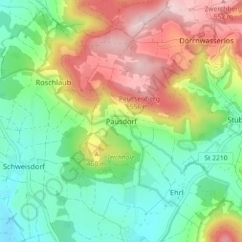
Name: Pausdorf topographic map, elevation, terrain.
Average elevation: 408 m
Minimum elevation: 304 m
Maximum elevation: 568 m
Thank you for supporting this site ❤️
Make a donation
Make a donation
Other topographic maps
Click on a map to view its topography, its elevation and its terrain.