
Thank you for supporting this site ❤️
Make a donation
Make a donation
Beit Fajjar topographic map
Click on the map to display elevation.
Thank you for supporting this site ❤️
Make a donation
Make a donation
Beit Fajjar
The site's high altitude was the highest point in the area and later the town expanded into other hills. During British rule in Palestine in the 1920s-1940s, Beit Fajjar was used as an observation point for the Bethlehem-Hebron area.
Thank you for supporting this site ❤️
Make a donation
Make a donation
About this map
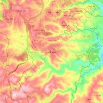
Name: Beit Fajjar topographic map, elevation, terrain.
Location: Beit Fajjar, Area B, West Bank, Palestinian Territory (31.58320 35.11387 31.66320 35.19387)
Average elevation: 878 m
Minimum elevation: 688 m
Maximum elevation: 1,013 m
Thank you for supporting this site ❤️
Make a donation
Make a donation
Other topographic maps
Click on a map to view its topography, its elevation and its terrain.