
花土沟镇 topographic map
Interactive map
Click on the map to display elevation.
About this map
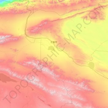
Name: 花土沟镇 topographic map, elevation, terrain.
Location: 花土沟镇, 茫崖市, 海西蒙古族藏族自治州, 青海省, 816400, 中国 (37.02047 90.40345 38.98289 93.14432)
Average elevation: 3,552 m
Minimum elevation: 1,902 m
Maximum elevation: 5,749 m
Other topographic maps
Click on a map to view its topography, its elevation and its terrain.